
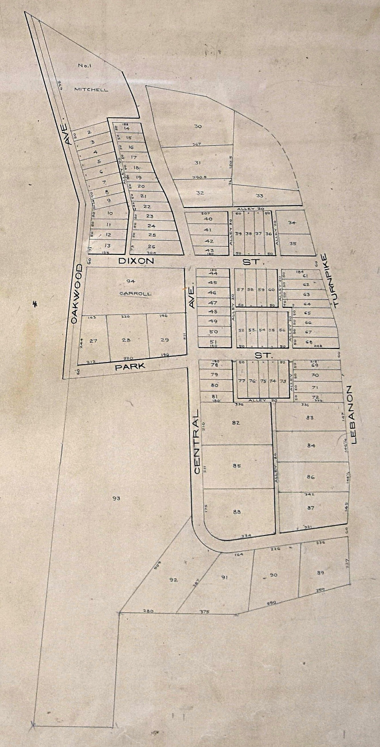
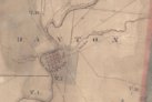
Plat of the original Oakwood Settlement (1872) |
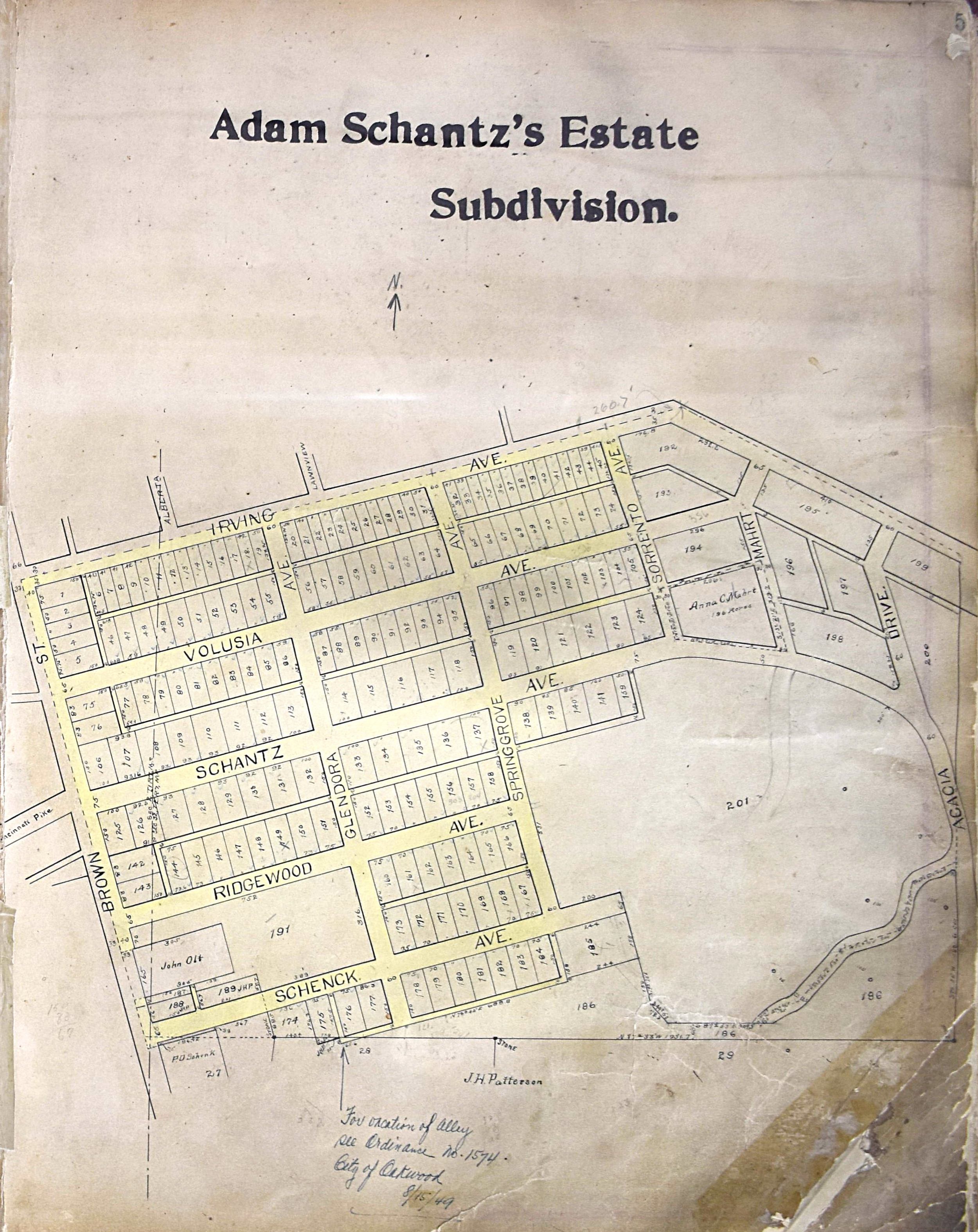
Plat of Adam Schantz's Estate Subdivision (1907) |
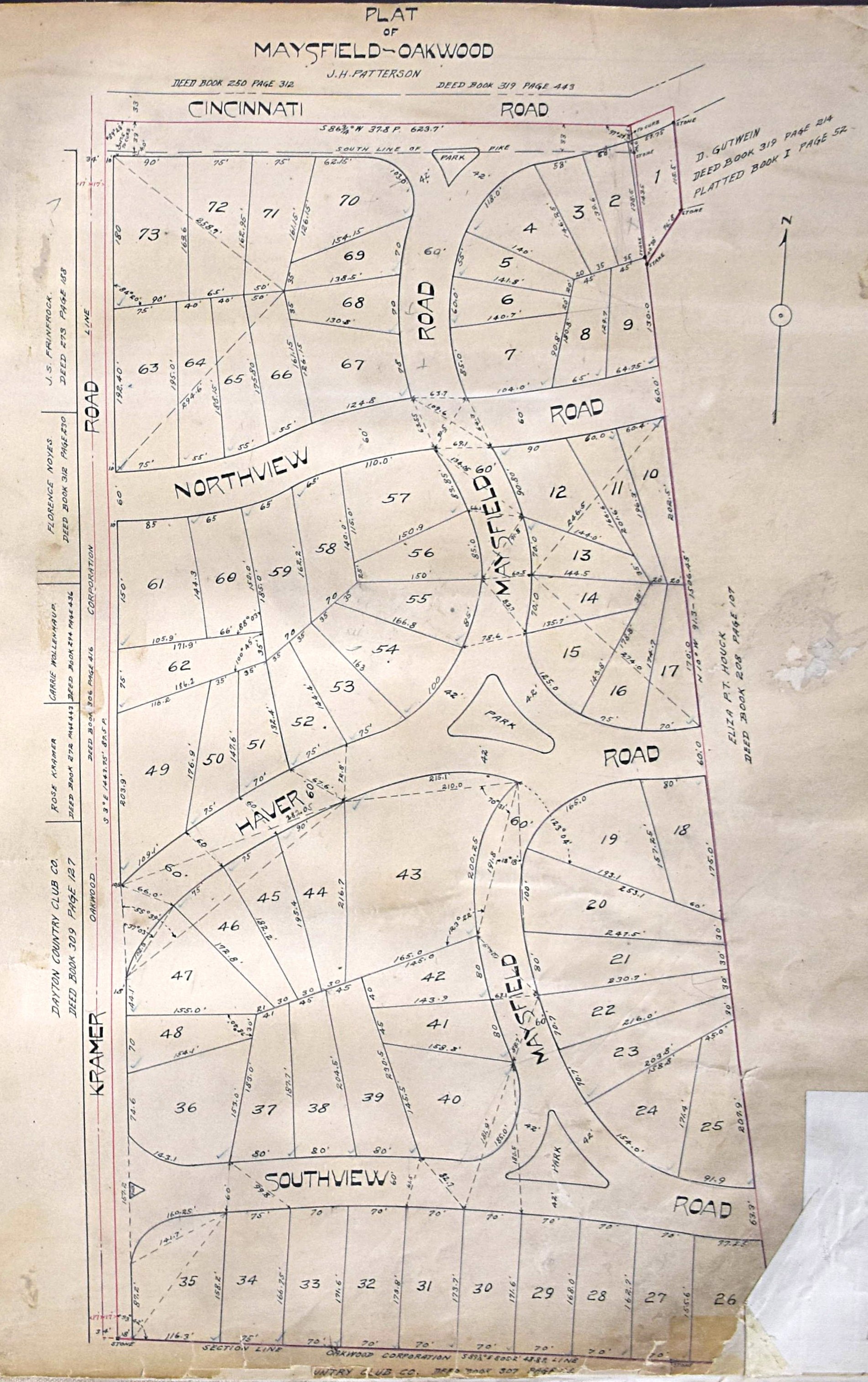
Plat of Maysfield-Oakwood (1912) |
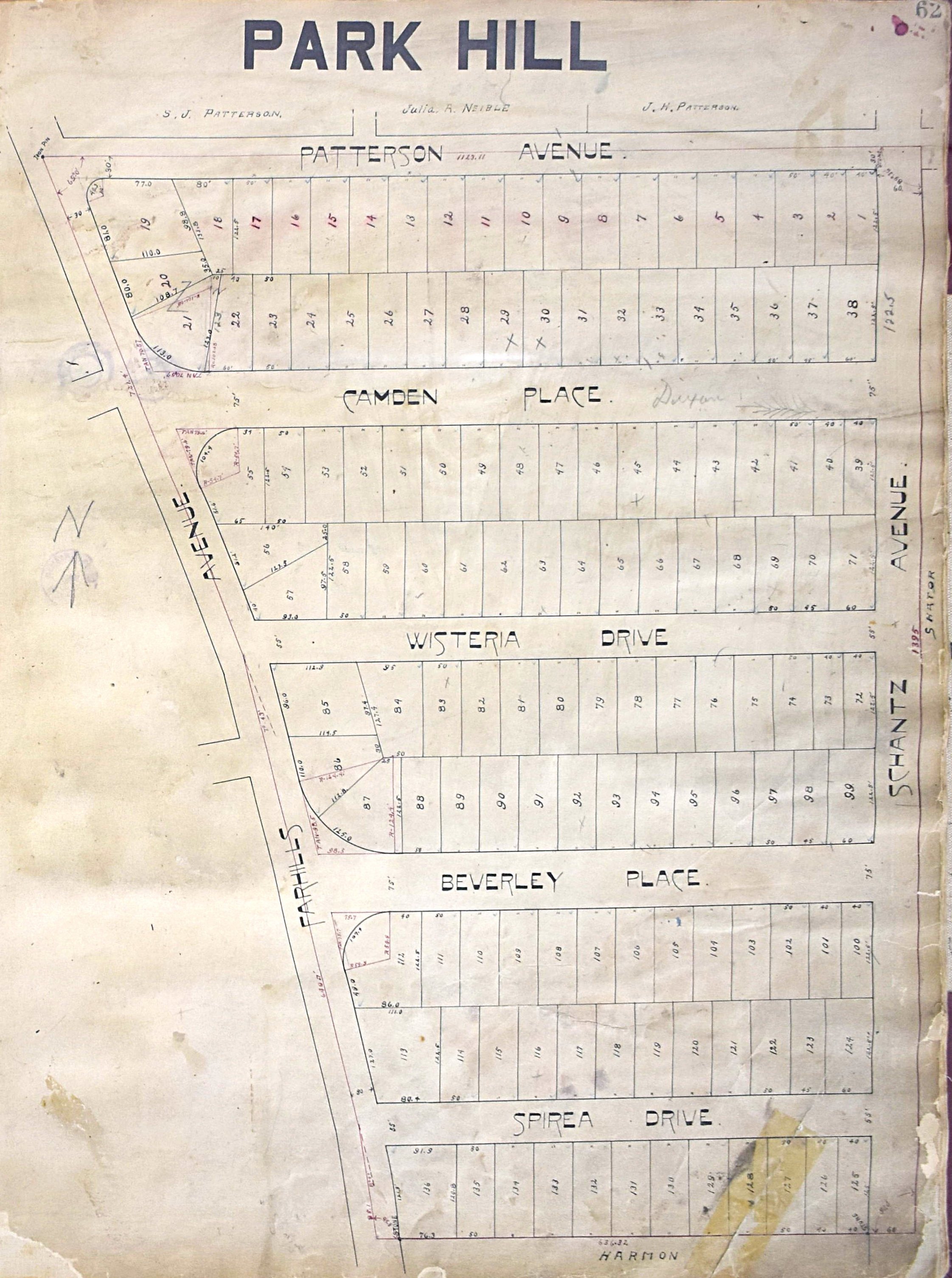
Plat of Park Hill (1913) |
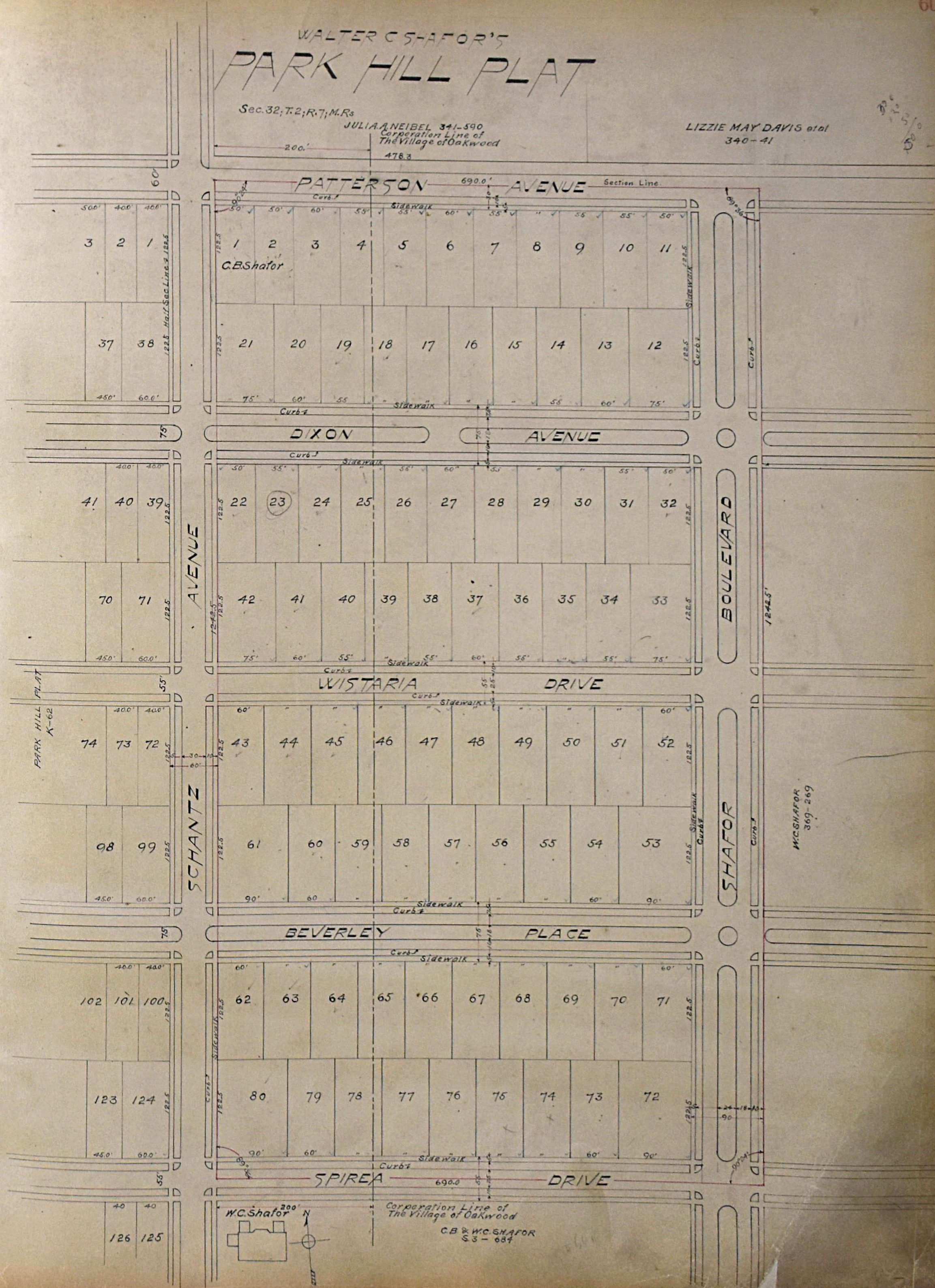
Plat of Walter Shafor's Park Hill (1915) |

Sanborn Fire Insurance maps available online via the OPLIN databases at Wright Memorial and Dayton Metro public libraries. Search for a street name and then select to view the map that best describes your request. You will need your library card to log in. |
Dayton Remembers: Preserving the history of the Miami Valley page at Dayton Metro Libraries. Includes: 1938 Plat maps (look for Oakwood in the Van Buren Township map) Montgomery County, 1832 1913 Flood area map; and more. |
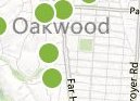
Notable Features from the City of Oakwood website. More maps from the city here |

Bike Trails in the Miami Valley. Interactive map of the 340 miles of trails in and around Dayton. Link to the Miami Valley Trails website |

Greater Dayton RTA bus maps: GDRTA Bus Locator Map. You need to select the routes, and it tells you graphically where the buses are. Route 17 on Shroyer Rd Route 5, Far Hills Ave (only runs twice a day) Route 14, Far Hills Ave |
Montgomery County Geographic Information System (GIS) maps. [NOTE: Doesn't work well in Firefox] |